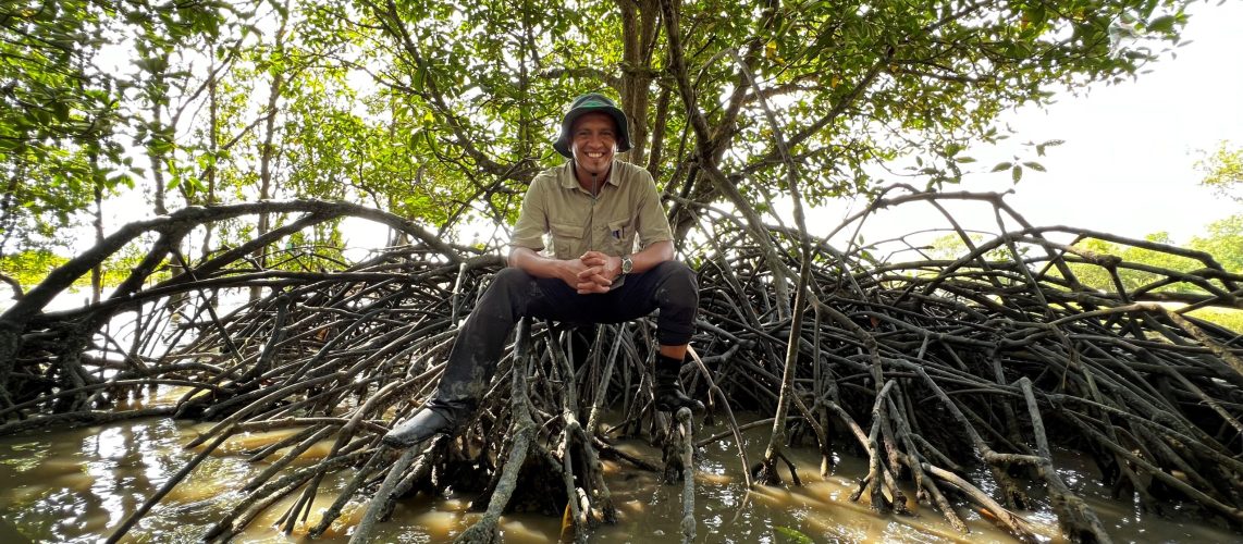
This article has been published in the New Straits Times on 27th December 2019.
Mangroves are making the headlines again in the continuous conflict between development and the preservation of nature.
The survival of a stretch of mangroves and mudflats near Penaga and Kuala Muda is under threat by the proposal from the Penang Aquaculture Industrial Zone.
In neighbouring Kedah, the mangroves of Sungai Merbok are declining fast, due to the clearing of mangrove forests to make way for shrimp farming, housing and other developments.
Bear in mind, these were the worst-impacted sites in Peninsular Malaysia during the Boxing Day tsunami that happened exactly 15 years ago.
The scars of the natural disaster can still be seen and the emotions are still felt by the locals, but sadly, we never learn.
The mangroves of Penaga and Kuala Muda have played an instrumental role in protecting the coastline and the surrounding communities from the immediate effects of winds and waves from the Straits of Malacca.
Besides, both these areas are primary stopovers for seasonal migratory birds and are home to a large diversity of plants and marine fauna.
The fishing villages there are the main attractions for locals and foreigners, who crave seafood.
A large portion of Sungai Merbok’s mangroves, on the other hand, has been protected as a permanent forest reserve since 1951 for biodiversity conservation, fisheries resources, coastal and estuarine protection, flood mitigation, carbon sink and many other ecosystem services, benefiting the local communities who have lived there for generations.
Sungai Merbok is gaining attention from tourists following the establishment of the Jerai Geopark.
Sungai Merbok has been a haunt of historians, scientists and nature enthusiasts for a long time because of its rich natural and cultural history and heritage.
It is the location of the ancient civilisation of Kedah, which had flourished to become one of the most advanced in the region.
Like many other past civilisations, it began in major river valleys and deltas.
Mesopotamia, for example, was located at the confluence of the rivers Tigris and Euphrates.
In addition to the archaeological evidence, it is also important to note the fascinating dynamics of the coastal landscapes of Merbok.
In recent geologic past, the peak of Gunung Jerai, Bukit Meriam and Bukit Peteri were islands fronting an area used to be known as the Kedah Bay.
As sea levels dropped during the Late Holocene, the foot of Gunung Jerai and the land extending towards Tanjung Dawai were exposed.
On the southern side, the land area of Sungai Petani appeared to be extending to Pantai Merdeka.
A new fertile estuarine delta was then formed on both sides as can be seen today.
The morphology change of the Merbok estuary and delta was sporadically depicted in the Kedah Annals (Hikayat Merong Mahawangsa), which proved to be an important reference for historians and scientists.
The mangroves and the coastal habitats forming the facade of this estuary are still undergoing a natural dynamic process.
Now, however, as we are entering the Anthropocene epoch, natural environments are heavily influenced by anthropogenic forces, and this is clearly witnessed in this site.
In my current analyses, I discovered a dramatic decline in the mangrove area in this site since the 1960s.
It is devastating to see even more land-use change occurring right after the 2004 tsunami and continuing until today.
As mentioned earlier, we definitely haven’t learnt from the past catastrophe how vulnerable our coastline is, and how important it is to protect mangroves and the coastal habitats.
The question is, who should regulate this? The answer is simple.
The power lies in the hands of the landowner, that is, the state government. As we all know in Malaysia, land is a state matter.
A strong consideration of the integrity of the natural environment and resources must be a priority before any decision is made to de-gazette a mangrove forest reserve, or convert it for other land use.
The forests and estuaries took thousands of years to shape and develop, but we take hours and just days to clear and convert them.
Imagine the sudden loss of habitat for the plants and animals, and the lost opportunity for carbon absorption, with the carbon being released due to forest cutting and land clearing.
A developed state does not necessarily need extensive physical structures or a surplus in houses and business areas.
What is paramount is ensuring a balance — that the basic needs and welfare of society are well taken care of and the environment is protected and preserved.
We must learn to appreciate and understand the tolerable threshold of the natural environment so that we can manage and promote sustainable development, such as lowering the risks and hazards from natural and anthropogenic disturbances.
We must also take into account the “real” need for physical development, and reflect on all the abandoned, failed and unnecessary development.
Let us be proud of our diverse tropical heritage and grow to become a developed country surrounded by these beautiful and precious resources.
We must be firm and resolute in adopting the principle of wise use and sustainable development.
Learn from past mistakes, and change we must to ensure the survival of our future generations.
The writer, a Malaysian Mangrove Research Alliance and Network coordinator, is a senior lecturer and research fellow at the Institute for Environment and Development, Universiti Kebangsaan Malaysia
